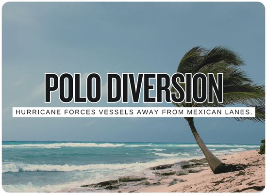
Hurricane Polo Forces Ships Away From Mexican Pacific Lanes After Category 5 Peak
🔔 Subscribe to ShipUniverse Weekly →
Hurricane Polo is beginning to alter commercial shipping patterns along Mexico's Pacific coast after explosively strengthening to Category 5 and reaching 180 mph winds with a minimum pressure of 892 mb on September 22. AIS data supplied by Pole Star Global showed merchant vessels already moving farther offshore to avoid Polo's wind and wave field, including ships on north-south routes and traffic serving Manzanillo. By 3 a.m. CST on September 23, Polo had weakened slightly below Category 5 intensity to 155 mph but remained a powerful major hurricane about 185 miles south of Zihuatanejo and 335 miles southeast of Manzanillo, moving north at only 2 mph as its outer rainbands reached Mexico. Manzanillo and Lázaro Cárdenas have restricted navigation for vessels under 500 gross tons, while commercial ships in port have been told to reinforce moorings and monitor additional maritime warnings.
Polo's Wind Field Is Rewriting Vessel Routes
Polo intensified from an ordinary tropical storm into one of the most powerful cyclones of the 2026 Pacific season in roughly a day. Its center remains offshore, but ships do not need a landfall to face dangerous winds, swell and routing disruption.
Mexican Pacific Shipping Exposure
Polo is affecting the coast in different ways. Offshore merchant ships are changing tracks, small-vessel navigation has been closed at major ports, and large commercial terminals remain under heightened operating precautions.
| Location / Route | Current Status | Confirmed Maritime Action | Commercial Exposure | Next Risk | Operating Picture |
|---|---|---|---|---|---|
| Pacific Coastal Shipping Lanes VESSELS DIVERTING | Merchant ships are maintaining increased separation from Polo's center and high-wave zone. | Pole Star Global AIS data shows vessels already altering tracks and moving farther offshore. | North-south services linking Panama, Central America, Mexico, California and Asia-facing gateways may experience additional sailing distance or changed arrival windows. | Polo is forecast to move northwest, carrying the routing conflict progressively along the Mexican coast. | This is a weather-routing diversion rather than a formal closure of the entire Mexican Pacific shipping lane. |
| Manzanillo RESTRICTED | Port closed to navigation by vessels below 500 gross tons from 09:00 September 22. | Ships remaining alongside were told to reinforce mooring lines. Export-container deliveries were also temporarily postponed during Tuesday's operations. | Manzanillo handled 2.456 million TEU in the first seven months of 2026, equal to 43.4% of Mexico's national container throughput. | Swell, rainbands, wind and port-approach conditions as Polo begins moving northwest. | No blanket shutdown of large commercial terminals had been announced in the latest available port notices. Restrictions currently distinguish between small craft and major merchant shipping. |
| Lázaro Cárdenas SMALL CRAFT CLOSED | Navigation below 500 gross tons closed from 16:00 on September 21 until further notice. | Larger merchant ships alongside were advised to reinforce lines, implement storm precautions and follow port captain safety notices. | The port had handled more than 17.4 million tonnes of cargo through July 2026 and is a major container, automotive and bulk gateway. | Polo's core lies south of the Michoacán coast while outer rainbands and swell reach the region. | The current restriction does not itself constitute a full commercial-port closure, but weather can still affect pilotage, berthing and arrival sequencing. |
| Zihuatanejo / Acapulco Coast NAVIGATION RESTRICTED | Coastal navigation restrictions have been imposed at several Guerrero ports and harbors. | Authorities have restricted navigation around Acapulco, Puerto Marqués and Zihuatanejo as rough seas move into the coast. | Primarily fishing, passenger, recreational and local marine activity, although the region also sits beside through-routing merchant traffic. | The NHC says Polo's outer rainbands are already reaching southwestern Mexico. | Zihuatanejo was approximately 185 miles north of Polo's center in the latest NHC advisory. |
| Baja California Sur Approaches NEXT WATCH AREA | Normal conditions currently farther north, but deterioration is forecast later in the week. | NWS marine forecasts carry Polo northwest toward waters southwest of Baja California. | Asia-West Coast Americas routes, Baja coastal services and vessels approaching the Gulf of California may need to account for changing swell fields. | Swells from Polo may mix with Hurricane Odalys, creating confused and hazardous seas during the weekend. | Shipping exposure may migrate north even if Polo never makes a direct Mexican landfall. |
Hurricane Reroute Cost & ETA Analyzer
Estimate the commercial effect when a vessel moves farther offshore to avoid a tropical cyclone's wind and wave field.
We welcome your feedback, suggestions, corrections, and ideas for enhancements.
Please click here to get in touch