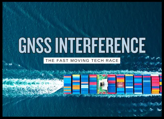
When GPS Lies at Sea: The New Maritime Tech Race Around GNSS Jamming, Spoofing, and Positional Trust
March 13, 2026
When GPS lies at sea, the risk is rarely “loss of a nice-to-have.” GNSS is welded into everything from ECDIS positioning and AIS time stamps to satellite comms timing and automated reporting. In March 2026, multiple maritime security updates for the Gulf region have described GNSS interference, spoofing, and jamming as a persistent operating condition, with observed impacts including positional offsets, AIS anomalies, and degraded positional integrity. IMO, ICAO, and ITU have also publicly raised concern about rising interference with satellite navigation. The result is a fast-moving tech race: bridge procedures, sensor fusion, resilient PNT, and software detection are becoming a competitive operational edge, not just a compliance item.
The March 2026 operating picture
Multiple updates tied to Gulf operations describe degraded positional integrity as a risk amplifier, especially when congestion and holding patterns rise. The practical effect is that bridge teams can see a “normal looking” ECDIS picture that is wrong, while AIS tracks may appear to jump, drift, or stack unnaturally. That creates a double risk: navigational error and decision error.
- Persistent interference environment: UKMTO JMIC updates describe significant GNSS interference continuing across the Strait of Hormuz approaches and nearby waters, with observed impacts including positional offsets, AIS anomalies, and intermittent signal degradation.
- Congestion plus degraded PNT: advisories warn that congestion combined with degraded positional integrity raises the probability of navigational incidents and miscalculation.
- International alarm signal: IMO, ICAO, and ITU issued a joint statement raising grave concern over increased jamming and spoofing of satellite navigation systems.
Source anchors used for freshness and accuracy:
UKMTO JMIC Advisory 11 Mar 2026
|
UKMTO JMIC Advisory 09 Mar 2026
|
IMO ICAO ITU joint statement 25 Mar 2025
Three failure modes and the signs operators actually see
The fastest way to cut through jargon is to separate the problem into jamming, spoofing, and timing drift. All three can exist in the same area, and the bridge team usually encounters them as confusing second order effects: unexpected cross track error, odd speed over ground, unnatural AIS plots, and sensor disagreement.
| Failure mode | What it does technically | Bridge level symptoms | First practical responses |
|---|---|---|---|
|
Jamming
Signal denial
|
Overwhelms the GNSS receiver with interference so it cannot decode satellite signals. Depending on receiver design, it may drop satellites, degrade accuracy, or fall back to dead reckoning. | Sudden loss of GNSS fix quality, fewer satellites tracked, position accuracy alarms, inconsistent SOG and COG, and sensor disagreement that appears to come and go. | Cross-check position with radar ranges and bearings, visual fixes where possible, and independent sensors. Reduce automation dependence, tighten bridge resource management, and document timing of loss and recovery. |
|
Spoofing
False position
|
Feeds the receiver false but plausible satellite-like signals so the unit computes a position that looks valid. This is often more dangerous than jamming because it can look clean. | “Perfect” position that does not match radar, coastline, soundings, or visual cues. AIS plots may jump inland or cluster unnaturally. ECDIS track appears stable while reality disagrees. | Treat GNSS as suspect until validated. Compare radar overlay to charted land, use parallel indexing, and apply a defined sensor trust hierarchy. Escalate to “positional integrity degraded” posture. |
|
Timing drift and partial degradation
Hidden bias
|
Receiver remains locked but accuracy or timing is biased. In practice, this can corrupt time stamping, AIS behavior, and integrated systems that rely on GNSS timing. | Small persistent offsets, odd AIS tracks, inconsistent CPA and TCPA behavior, and increased nuisance alarms. Symptoms are often subtle until the ship is in constrained waters. | Increase cross-check frequency, compare multiple GNSS constellations if available, and validate against radar and known marks. Record offsets and share with operations for pattern recognition. |
Current relevance: UKMTO JMIC notes for early March 2026 describe positional offsets, AIS anomalies, and intermittent signal degradation in the Hormuz region, consistent with the symptoms above.
(https://www.ukmto.org/-/media/ukmto/products/update-010---jmic-advisory-note-10_mar_2026_final.pdf)
The tech race around positional trust
The “race” is not one product. It is layered resilience. Vendors and operators are moving toward assured PNT approaches that combine detection, alternative sensors, and disciplined procedures. A practical way to think about it is to separate four layers: detect, cross-check, continue navigating safely, then prove what happened afterward.
- Detection layer: receiver health, satellite count anomalies, signal-to-noise monitoring, spoofing detectors, and alerting that is meaningful rather than noisy.
- Cross-check layer: radar overlay validation, visual bearings, depth and contour logic, inertial and doppler inputs, and sensor fusion that flags disagreement.
- Continuity layer: bridge procedures designed for degraded positioning, including conservative CPA thresholds, speed management, and defined hold points when operating near congestion.
- Evidence layer: logs, screenshots, ECDIS track exports, and time aligned narratives that support incident review, claims, and counterparty discussions.
Related guidance and industry context:
IMO ICAO ITU statement
|
IALA catalogue referencing Resilient PNT guidance
Position integrity risk screener
A fast, directional tool for operations teams. It does not predict an attack. It helps decide how conservative the bridge posture should be when conditions increase the consequence of a wrong position.
Adjust inputs to see a recommended posture and the first actions to prioritize.
Freshness check: UKMTO JMIC advisories in early March 2026 describe significant GNSS interference and AIS anomalies in the Hormuz operating area.
Open advisory
GNSS integrity bridge checklist
Use this when GNSS is suspected wrong. Check the actions completed and the panel below will produce a posture band, a gap list, and an evidence pack prompt.
Designed for constrained waters, approaches, and congestion. Align with company procedures and master judgment.
Immediate posture shift
Stop treating GNSS as truth until validated.
- Declare position integrity degraded and adopt conservative margins
- Verify active sensor source feeding ECDIS and integrated systems
- Tighten CPA and TCPA thresholds and increase watch intensity
- Time stamp first anomaly so logs align later
Fast validation checks
Prove or disprove the GNSS position using independent references.
- Radar overlay and coastline matches charted land and marks
- Radar ranges and bearings agree with plotted position
- Depth and contour logic matches expected soundings
- Cross-check receiver sources across units or constellations
Congestion and approach discipline
Avoid compounding risk in holding and close quarters.
- Set defined hold points with limits and contingency actions
- Speed management prioritizes control over schedule
- VHF discipline tightened to reduce confusion
- Escalation triggers defined for delaying entry or requesting support
Evidence pack
Make the event provable and comparable across voyages.
- Save screenshots of ECDIS, radar overlay, and alarms
- Export track data and record observed offsets with times
- Record receiver health indications if available
- Write a clean narrative of actions taken and when confidence returned
Check items, then select Build status note.
We welcome your feedback, suggestions, corrections, and ideas for enhancements. Please click here to get in touch.