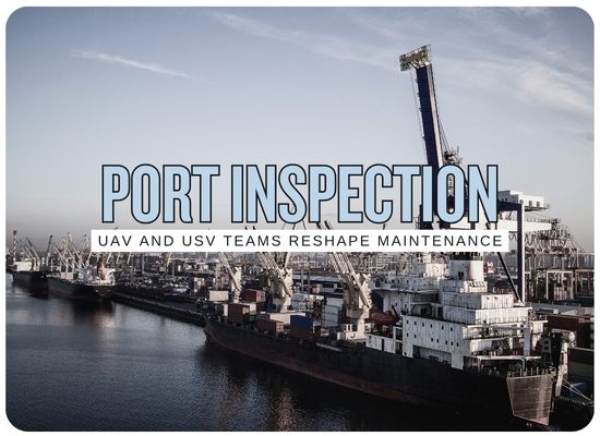
Autonomous Port Inspection Could Turn UAV and USV Teams Into the New Maintenance Crew
🔔 Subscribe to ShipUniverse Weekly →
Ports are becoming inspection networks, not just inspection sites
The next step in port maintenance is coordinated sensing. UAVs can scan above-water assets, roofs, cranes, lighting, roads, stacks, security zones, and oil sheen. USVs can inspect berth pockets, quay faces, fenders, piles, water surfaces, bathymetry, and restricted areas. AI can connect the evidence into maintenance priorities before asset deterioration disrupts a berth.
The first gain is better coverage without blocking operations
Ports have a maintenance problem that looks different from a vessel maintenance problem. The asset is large, busy, mixed-use, and constantly interrupted by commercial operations. A quay wall cannot simply disappear from service every time an engineer wants a closer look. A berth pocket cannot always wait for a survey vessel. A storm-damaged fender, a drifting obstruction, or a suspected oil sheen may need quick confirmation before the port can decide whether to close, clean, repair, or keep operating.
Autonomous inspection teams can reduce this friction. A UAV can scan visible infrastructure and create a fast aerial record. A USV can collect surface-level imagery, bathymetry, sonar, or water-quality data. AI can compare current evidence with previous inspections, flag abnormal conditions, and prepare a report for engineers, safety teams, terminal planners, or environmental managers.
Large ports, container terminals, LNG terminals, cruise ports, ferry terminals, industrial waterfronts, offshore bases, and ports with heavy dredging or quay-wall maintenance needs.
Traffic coordination, drone permissions, cybersecurity, data quality, collision avoidance, weather limits, night operations, privacy, and whether inspection findings can become trusted maintenance actions.
The strongest case is fewer blind spots, faster defect discovery, less disruption to terminal activity, and better evidence for asset planning.
UAV and USV teams are not just inspection gadgets. Used properly, they become a port condition layer that helps maintenance teams decide earlier and schedule smarter.
Autonomous port inspection can reshape these maintenance workflows
The most realistic missions are focused, repeatable, and tied directly to asset condition or operational continuity.
Quay wall and berth face condition checks
USVs can inspect waterline areas, vertical surfaces, fender zones, cracks, corrosion stains, scour indicators, and impact damage. UAVs can capture the top-side view of coping, pavement, drainage, bollards, and access areas.
Fender, bollard, dolphin, and mooring asset inspection
AI can compare images of fender panels, chains, bollards, dolphins, ladders, handrails, and mooring fixtures against previous records to flag deformation, corrosion, missing parts, or impact damage.
Berth pocket and channel depth monitoring
USVs can support hydrographic checks around berth pockets, siltation zones, turning basins, and channel edges. AI can compare survey results with prior depth profiles and terminal activity plans.
Floating debris, oil sheen, and spill surveillance
UAVs can rapidly spot surface anomalies over a wider area, while USVs can move closer for imaging, sampling, or boundary tracking. AI can help classify floating waste, oil sheen, foam, discoloration, or unusual surface patterns.
Storm, allision, and post-incident damage review
After severe weather, berth contact, crane impact, or vessel allision, UAV-USV teams can quickly collect a mixed aerial and water-level record before engineers enter harder-to-access areas.
Bridge, pier, and restricted-access structure inspection
UAVs can inspect high or difficult areas, while USVs inspect beneath or near the waterline. AI can help organize findings by structure, span, pier, pile, deck section, or maintenance zone.
Security perimeter and restricted-zone patrol support
UAVs and USVs can support patrol patterns around restricted basins, cruise terminals, energy terminals, anchorages, and critical infrastructure. AI can help flag unusual vessel, vehicle, or object behavior.
Crane, lighting, roof, and yard asset surveys
UAVs can capture visual and thermal records of lighting, roofs, drainage, cranes, conveyors, silos, tank farms, utility corridors, and yard surfaces. AI can group defects and trend deterioration over time.
Environmental baseline and habitat monitoring
USVs can carry water-quality sensors, sonar, or sampling equipment while UAVs map shoreline, wetlands, dredging zones, turbidity plumes, and restoration areas. AI can compare patterns across repeat missions.
UAVs and USVs solve different pieces of the port inspection puzzle
The strongest approach is not choosing air or water. It is assigning each platform to the inspection layer it handles best, then joining the evidence in one maintenance record.
| Inspection asset | Best coverage | Weak point | Best data output | Human role | Maintenance fit |
|---|---|---|---|---|---|
| UAV | Top-side infrastructure, roofs, cranes, lighting, roads, security zones, storm damage, floating waste | Wind, airspace rules, battery life, privacy, poor view under structures | High-resolution imagery, video, thermal, orthomosaic, anomaly tags | Approve flight plan, review defects, handle permissions | Strong |
| USV | Waterline, berth pockets, bathymetry, quay face, debris zones, environmental data, ROV support | Traffic conflict, currents, GNSS shadows, collision risk, launch and recovery | Sonar, depth profiles, water-quality data, water-level images, route logs | Set safety box, coordinate with marine traffic, validate survey data | Strong |
| AI vision | Defect detection, object classification, surface-change comparison, oil sheen or debris spotting | False positives, lighting changes, poor training data, confusing backgrounds | Defect tags, confidence scores, repeat-change logs, report drafts | Engineer confirms findings and assigns action | Growing |
| Mission planner | Task sequencing, route planning, coverage validation, UAV-USV coordination | Needs operational constraints and traffic awareness | Mission plans, dependency maps, route coverage, missed-area flags | Port operations approves mission timing | Growing |
| Human engineer | Repair judgment, asset prioritization, safety decisions, regulatory interpretation | Limited time and manual inspection burden | Approved defects, work orders, repair scope, asset condition ratings | Final authority over maintenance decisions | Essential |
The real upgrade is turning inspections into scheduled intelligence
Autonomous port inspection becomes valuable when data flows into maintenance planning, not when it stays in a folder of drone footage. The port needs a workflow that converts images, sonar, depth readings, and sensor logs into repair priorities.
Asset register alignment
Map inspection targets to asset IDs: quay sections, fenders, dolphins, bollards, piles, berth pockets, bridge spans, crane rails, lighting rows, and drainage zones.
Mission box approval
Define the airspace, waterspace, traffic window, weather limits, launch point, emergency stop, communications channel, and marine-traffic coordination.
Coordinated UAV and USV capture
Run aerial and surface missions with synchronized timestamps, route logs, asset labels, and missed-coverage flags.
AI-assisted condition review
Use AI to flag cracks, corrosion, deformation, debris, surface anomalies, depth changes, spill indicators, vegetation changes, or repeat defects.
Engineer approval and work-order routing
Human reviewers confirm defects, assign severity, add repair context, and push approved findings into the port maintenance system.
Trend review before budgeting
Compare repeat inspections over time so the port can separate urgent repairs from slow deterioration and plan capital work with better evidence.
Some maintenance jobs fit autonomous inspection better than others
Ports should start with repeatable work that creates disruption when it is delayed or poorly documented.
| Maintenance area | Best platform mix | AI contribution | Business value | Adoption blocker | Fit |
|---|---|---|---|---|---|
| Quay wall and berth face | USV plus UAV | Change detection, defect tags, coverage map | Earlier repair planning and better berth confidence | Water visibility, traffic windows, asset labeling | Strong |
| Berth pocket depth | USV with sonar or survey payload | Depth-change comparison and dredging priority support | Reduced surprise restrictions and better dredging timing | Survey accuracy, calibration, hydrographic standards | Strong |
| Fenders and mooring assets | UAV plus USV at waterline | Damage detection and repeat-condition comparison | Lower claims friction and safer vessel handling | Occlusion, shadows, and asset ID consistency | Strong |
| Floating debris and oil sheen | UAV for detection, USV for closer inspection | Object classification, boundary tracking, report draft | Faster response and cleaner evidence | Weather, lighting, false positives | Growing |
| Storm and incident review | UAV plus USV rapid survey | Damage grouping and pre-engineer triage | Faster reopening and claims documentation | Emergency coordination and safety zones | Growing |
| Crane and yard assets | UAV with visual or thermal payload | Crack, corrosion, heat, roof, and lighting anomaly tags | Better preventive maintenance planning | Flight permissions and terminal activity conflict | Growing |
| Environmental monitoring | USV sensors plus UAV mapping | Pattern comparison, turbidity or shoreline-change reporting | Better permit evidence and response planning | Sensor calibration and reporting standards | Selective |
| Security and restricted zones | UAV plus USV patrol routes | Object detection and anomaly alerts | Better situational awareness around critical infrastructure | Privacy, airspace, cyber, and response protocols | Selective |
Autonomous Port Inspection Fit Scorecard
Use this scorecard to estimate whether a port maintenance task is ready for UAV-USV inspection support.
This scorecard is a planning aid. Ports should still review aviation rules, marine traffic procedures, cybersecurity, insurance, privacy, emergency response, hydrographic standards, union or contractor boundaries, and local authority requirements.
Autonomy only helps if the port trusts the inspection record
The system has to do more than fly or float. It has to create evidence that engineers can use and operations teams can schedule around.
| Control point | Needed safeguard | Failure mode | Best owner | Decision supported | Priority |
|---|---|---|---|---|---|
| Asset ID discipline | Every image, sonar pass, and finding tied to a port asset ID | Drone footage cannot be linked to a work order | Asset management team | Maintenance planning | Very high |
| Coverage map | Show inspected areas, missed areas, and quality levels | Port assumes inspection was complete when gaps remain | Inspection manager | Follow-up scheduling | Very high |
| Traffic coordination | Mission windows coordinated with VTS, terminal, pilots, and marine operations | UAV or USV becomes an operational hazard | Marine operations | Safe deployment | Very high |
| AI confidence labels | Separate AI-suggested defects from engineer-confirmed defects | False alarms become repair orders or real issues are missed | Engineering team | Repair prioritization | High |
| Data integrity | Protect timestamps, location data, user edits, source footage, and report history | Evidence becomes weak for claims or compliance | IT and compliance | Claims and audit support | High |
| Cyber boundaries | Secure command links, cloud storage, remote access, and vendor support | Inspection system becomes a digital entry point | Cybersecurity team | Operational resilience | High |
| Human signoff | Engineer approval before work order, closure, dredging, or repair action | Automation creates action without context | Port engineer | Maintenance authority | Very high |
The first pilot should target a berth that already causes maintenance friction
Ports should not start with a broad autonomous-inspection program. A better first test is one berth, one asset group, one inspection mission, and one decision path. The port can then compare inspection time, defect discovery, evidence quality, safety exposure, and disruption against its current manual routine.
Pair a UAV and USV around a berth face, fender line, berth pocket, or post-storm damage route where manual inspection creates delay or incomplete evidence.
Buy the inspection workflow, not just the drone. Require asset IDs, coverage maps, defect tags, engineer review, exportable reports, and work-order integration.
Track inspection cycle time, berth disruption avoided, defect closure rate, dredging priority changes, incident response speed, and maintenance budget accuracy.
AI-powered UAV and USV teams can change port maintenance by creating a faster, safer, and more complete condition picture. The winners will be ports that turn autonomous inspection data into trusted repair decisions.
We welcome your feedback, suggestions, corrections, and ideas for enhancements.
Please click here to get in touch