
🔔 Subscribe to ShipUniverse Weekly →
A jammed GPS signal should trigger a navigation stack, not a single backup habit
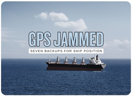
I would treat GPS jamming as a position-confidence problem rather than a simple receiver failure. The ship still needs to know where it is, where it is heading, which objects are real, which displayed positions can be trusted, and which fallback method the bridge should use next. That is why the future navigation conversation is moving toward assured PNT: LEO signals, inertial navigation, eLoran, radar positioning, visual fixes, multi-GNSS, and sensor fusion working together instead of waiting for one satellite receiver to recover.
The backup question has changed
A traditional bridge often treats GNSS as the center of the digital navigation picture. ECDIS, AIS, VDR, GMDSS, dynamic positioning, vessel tracking, alarms, time synchronization, route monitoring, pilot systems, offshore operations, and fleet platforms can all depend on satellite-derived position or timing. When GNSS is jammed or spoofed, the problem spreads fast because several systems may be wrong in the same direction.
The practical answer is not to replace GPS with one perfect alternative. Each backup has a different strength. INS preserves motion continuity. Radar and visual fixes tie the ship to the physical world. eLoran offers a terrestrial signal where infrastructure exists. LEO PNT offers a dissimilar satellite layer. Multi-GNSS improves satellite diversity but still needs interference detection. Sensor fusion ranks the disagreement and helps the bridge decide which source deserves confidence.
Create a GNSS-loss bridge map. List every system that receives GNSS position, timing, speed, heading support, or AIS-derived position, then define the fallback method for each one.
Owners buy a better GNSS receiver but underbudget antennas, INS integration, radar target extraction, eLoran receiver readiness, edge fusion software, alert presentation, and bridge procedure updates.
A serious assured-PNT quote should show normal mode, degraded mode, jammed mode, spoofed mode, fallback priorities, crew actions, and evidence recording.
The best navigation backup is not the one that sounds most advanced. It is the one that still gives the bridge a usable position or a usable cross-check when GNSS cannot be trusted.
A practical assured-PNT stack for ships
The strongest bridge design separates position sources from trust checks and crew response. That keeps the system from treating every displayed position as equally reliable.
Independent position and motion sources
Use sources that fail differently so one interference event does not blind the bridge.
Integrity and disagreement checks
Compare position, heading, speed, time, radar returns, AIS reports, inertial estimates, and known charted features.
Fusion and confidence scoring
Blend the usable sources, reject suspect inputs, and give the bridge a confidence level rather than a blind green light.
Bridge response and operating procedure
Show the crew which source is suspect, which backup is active, and which manual cross-check should come next.
The systems that can still help when GPS is jammed
These technologies are not equal substitutes. Some provide absolute position, some provide relative position, some provide motion continuity, and some mainly help decide which input is lying.
Low Earth orbit signals as a dissimilar satellite layer
LEO PNT is gaining attention because it uses a different orbital layer from traditional medium-orbit GNSS. LEO signals can be stronger at the receiver and have faster changing geometry, which can make them useful as a backup or cross-check in a degraded GNSS environment. For shipowners, the commercial question is availability, receiver maturity, antenna integration, service cost, and bridge acceptance.
Inertial navigation for motion continuity during outages
INS cannot stay perfect forever without updates, but it can preserve motion, heading, rate-of-turn, attitude, and dead-reckoned position when satellite inputs fail. The value depends on sensor grade, alignment, aiding sensors, drift rate, and how clearly the bridge sees the confidence decay over time.
Terrestrial PNT where infrastructure exists
eLoran is attractive because it is terrestrial and dissimilar from GNSS. It is not a universal answer unless infrastructure and receivers are available in the vessel’s operating region, but it can provide a valuable backup in covered waters and can support timing resilience as well as navigation.
Radar ranges and mapped objects as a physical-world check
Radar positioning is one of the most practical near-term backups because it ties the ship to coastlines, buoys, fixed structures, landmasses, and other physical returns. It is not a blue-water absolute-position solution, but in coastal waters, restricted waters, port approaches, and offshore fields, radar can challenge a false GNSS position quickly.
Visual bearings, optical aids, and camera-based fixes
Visual positioning sounds old-fashioned, but it remains important because it is independent of satellite signals. Bearings, transits, lights, landmarks, ranges, and camera-assisted recognition can give the bridge a direct reality check. The limitation is visibility, crew skill, chart quality, and the availability of identifiable objects.
More satellites, more frequencies, and authenticated signals
Multi-GNSS remains valuable because it improves constellation diversity and can support better integrity checks. It should not be treated as full jamming immunity, since a strong interference environment can still degrade multiple satellite systems. The stronger version includes multi-frequency operation, interference monitoring, antenna resilience, and authentication where available.
The decision layer that turns many inputs into usable confidence
Sensor fusion is not another sensor. It is the logic that compares sensors and helps the bridge decide which source to trust. It can blend GNSS, LEO PNT, INS, radar, AIS, eLoran, speed log, gyro, depth, charted features, and visual inputs. The strongest systems do not just provide a fused position. They also show uncertainty, suspect inputs, and fallback recommendations.
Each backup solves a different part of the jammed-GPS problem
Owners should avoid asking which technology is best in isolation. The better question is which combination gives the bridge enough confidence for the vessel’s route and operation.
| Technology | Primary value during GNSS jamming | Strongest operating zone | Main limitation | Buyer should request | Procurement priority |
|---|---|---|---|---|---|
| LEO PNT | Dissimilar satellite PNT layer and timing backup | Open sea, high-risk routes, remote waters, timing-dependent ships | Service maturity, receiver integration, subscription, bridge acceptance | Coverage, antenna plan, receiver certification, outage behavior, data interface | High-growth |
| INS | Motion continuity and short-term dead reckoning | DP, offshore, survey, restricted water, critical maneuvers | Drift without external aiding | Drift profile, aided mode, alarm logic, confidence decay display | Very high |
| eLoran | Terrestrial backup independent of satellites | Covered coastal waters and national resilience zones | Infrastructure availability and receiver adoption | Coverage, receiver compatibility, antenna plan, accuracy expectation | Route dependent |
| Radar positioning | Physical-world check against charted and observed objects | Coasts, ports, channels, offshore structures, traffic separation areas | Limited open-sea absolute positioning | Radar overlay accuracy, target extraction, range-bearing workflow, chart alignment | Very high |
| Visual positioning | Independent manual or optical confirmation | Coastal water, pilotage, daylight or good-visibility approaches | Weather, darkness, human workload, identifiable marks | Bridge procedures, camera assist, training, fix intervals, logging rules | Essential procedure |
| Multi-GNSS | Constellation and frequency diversity with better integrity checks | General fleet upgrade and bridge modernization | Not immune to strong interference or coordinated spoofing | Multi-frequency support, authentication, anti-jam antenna, integrity outputs | Baseline upgrade |
| Sensor fusion | Trust ranking, anomaly detection, and fallback logic | All complex vessels with multiple position and motion sources | Needs clean integration and crew-readable presentation | Confidence score, suspect-source labeling, event replay, ECDIS interface | Very high |
Build the fallback stack before buying the newest receiver
A resilient bridge upgrade starts with operating modes and failure cases, not with a single product brochure.
Map GNSS dependency
List every bridge, communications, safety, timing, offshore, cargo, DP, and fleet system that depends on satellite position or time.
Define the jammed-mode requirement
Separate open-sea navigation, coastal approach, pilotage, port maneuvering, DP operation, offshore work, emergency response, and VDR evidence needs.
Choose independent layers
Select a route-specific mix of multi-GNSS, INS, radar positioning, visual fixes, eLoran, LEO PNT, acoustic or local positioning, and fusion software.
Design bridge presentation
Make sure the crew sees confidence, suspect sources, fallback priorities, and manual cross-check prompts instead of receiving vague alarms.
Test, log, and drill
Run GNSS-degraded drills, capture event data, update the SMS, and verify that the bridge can navigate without blindly trusting the satellite feed.
GPS Jamming Navigation Resilience Scorecard
Use this planning tool to estimate whether a vessel has a real fallback stack or mainly a better GNSS receiver.
This scorecard is a planning aid. Final design should involve bridge electronics suppliers, radar and ECDIS integrators, INS vendors, antenna specialists, class, masters, DP specialists where applicable, and the owner’s safety-management team.
Navigation vendors should prove degraded-mode behavior
A bridge upgrade is not resilient until the owner can see how the system behaves when GNSS is unavailable, misleading, or unstable.
| Buyer demand | Reason it matters | Weak answer | Strong answer | Document to request | Priority |
|---|---|---|---|---|---|
| Jammed-mode behavior | The bridge needs predictable behavior when GNSS disappears | Receiver alarms when GPS is lost | Fallback source, alerting, display behavior, and crew action defined | GNSS-degraded operating mode document | Very high |
| Spoofing detection | A false position may look normal unless cross-checked | Anti-spoofing supported | Integrity flags, sensor disagreement, suspect-source labeling, and event recording explained | Spoofing detection and alert logic | Very high |
| INS drift and confidence decay | Dead reckoning gets weaker over time | INS provides backup | Drift profile, confidence display, aiding sensors, and time limits stated | INS performance and integration file | High |
| Radar positioning workflow | Physical-world checks are crucial near land and structures | Radar overlay available | Range-bearing workflow, ECDIS integration, chart alignment, and operator procedure provided | Radar positioning procedure | High |
| Alternative PNT path | LEO PNT or eLoran may add a dissimilar layer | Alternative source can be added later | Receiver, antenna, coverage, service, interface, and pilot path defined | Alternative PNT integration plan | Route dependent |
| Fusion logic | Many inputs can confuse the bridge without ranking | System uses multiple sensors | Confidence score, input weighting, rejected-source logic, and event replay included | Sensor fusion and confidence-score method | Very high |
| Crew procedure | Technology needs an immediate bridge action | Training available | SMS-ready checklist, drills, watchkeeper actions, master notification, and reporting steps provided | GNSS interference response procedure | Very high |
| Evidence and replay | Owners need proof for incident review and tuning | Logs are available | Time-aligned event logs, source changes, alerts, positions, and replay export included | Event logging and replay sample | High |
The strongest fleets will not wait for GPS to fail
GNSS interference readiness should be treated like a bridge modernization and safety-management project, not just a receiver replacement. The highest-value packages will combine antennas, multi-GNSS, LEO PNT or terrestrial alternatives where available, INS, radar positioning, visual procedures, fusion software, bridge alerting, and replay evidence.
Select one vessel on a route with known GNSS interference exposure and test GNSS-degraded behavior using the actual bridge systems, not just a desktop study.
Do not buy a “GPS backup” until the vendor proves degraded-mode behavior, source ranking, bridge presentation, and crew response.
Track GNSS dependency count, available independent sources, fallback time, INS drift window, radar-fix readiness, alternative PNT coverage, crew drill completion, and event-replay quality.
When GPS is jammed, the ship does not need one miracle replacement. It needs enough independent evidence to keep navigating safely and enough bridge logic to know which evidence deserves trust.
We welcome your feedback, suggestions, corrections, and ideas for enhancements.
Please click here to get in touch