Finland sets up Baltic Subsea Monitoring Center with EU and regional partners
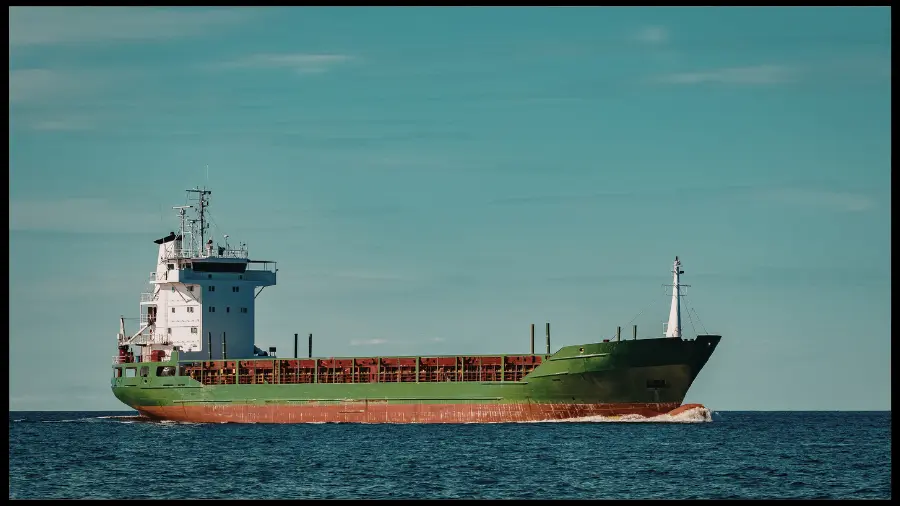
Finland’s Border Guard says it is working with the European Commission and other Baltic Sea countries to stand up a maritime surveillance center focused on protecting critical undersea infrastructure in the Gulf of Finland. The initiative is framed around faster detection, shared situational awareness, and clearer authority to intervene when incidents occur in territorial waters or exclusive economic zones, following a run of cable, power-link, and pipeline disruptions in the region.
Subscribe to the Ship Universe Weekly Newsletter
Click here for 30 second summary
Baltic subsea monitoring in one read
Finland’s Border Guard says it is working with the European Commission and Baltic Sea partner states to establish a maritime surveillance center focused on protecting critical undersea infrastructure in the Gulf of Finland. The initiative is positioned around better shared awareness and faster response when incidents occur in territorial waters or exclusive economic zones, following repeated seabed-link disruptions in the region.
- A joint surveillance center is being prepared with EU participation and regional partners.
- The focus is critical undersea infrastructure and faster response to incidents.
- The operating environment around sensitive corridors is expected to draw more attention and quicker intervention when anomalies appear.
More monitoring increases the odds that corridor-adjacent anomalies are detected early, which can translate into more authority contact, more questions, and more need for clean explanations of track behavior in the most sensitive Baltic zones.
| Move | What is being set up | Operating effect | Commercial read-through |
|---|---|---|---|
| Joint surveillance center | Finland’s Border Guard says a maritime surveillance center is being established with the European Commission and Baltic Sea partner states, focused on undersea infrastructure protection in the Gulf of Finland. | More persistent monitoring and faster anomaly flagging around seabed corridors and approach lanes tied to cable and energy links. | More voyages near sensitive corridors may face added reporting, questions, or post-event verification requests. |
| Intervention authority emphasis | Finland highlights the need for competent authorities to have both capability and authority to act when incidents occur in territorial waters and exclusive economic zones. | Higher likelihood of early contact, boarding readiness, or instruction changes when an incident pattern is suspected. | Charterers and operators may price more schedule buffer for transits and port approaches in the most monitored zones. |
| Incident-driven posture | The initiative is framed as a response to repeated disruptions to power cables, telecom links, and pipelines since 2022, with heightened alertness in the region. | More “watch list” behavior for ships with unusual track patterns, slow drift, prolonged loitering, or anchor activity near corridors. | More counterpart preference for clean AIS behavior, clear passage plans, and ready documentation for calls and transits. |
| Cross-border coordination | Regional alignment with EU participation suggests a shared operating picture and faster information handoff between jurisdictions in the Gulf of Finland. | Less room for jurisdiction gaps during an incident, with quicker coordination between agencies when a cable or corridor alert triggers. | Operators may see more standardized questions and data requests across ports and coastal states in the same basin. |
| Broader security environment | NATO has also stepped up its presence in the Baltic Sea with maritime and aerial assets as regional infrastructure security remains elevated. | Denser patrol and monitoring environment increases the chance that unusual behavior is observed and acted on quickly. | Routing and timing decisions increasingly account for attention level, not only distance and weather, for Baltic transits. |
- Transit segments that overlap cable and power-link corridors
- Slow-speed zones near traffic separation schemes, approaches, and pilot areas
- Anchorage decisions when seabed corridors run close to designated waiting areas
- Unplanned speed or course changes caused by weather, traffic, or machinery constraints
- Extended loitering or drift near corridors without a clear operational reason
- Repeated course reversals, tight circles, or prolonged low speed outside normal practice
- Anchoring close to known subsea corridors or in unusual locations for the voyage profile
- AIS gaps or identity inconsistencies during corridor-adjacent movement
- Passage plan extracts showing intended corridor clearance and contingency routing
- Anchor decision rationale when waiting is required (weather, traffic, berth window)
- Bridge log notes for any course or speed changes that look unusual on AIS
- Contact points onboard and ashore for rapid confirmation if queried
Interactive transit planner
Choose the transit profile to generate an “attention level” and a short operational checklist for corridor-adjacent movement.
As monitoring and coordination increase around Baltic seabed corridors, the likelihood of early contact and intervention rises. For operators, that typically translates into more scrutiny of corridor-adjacent movement, more value placed on clean AIS behavior and clear passage-plan logic, and a higher need to explain any unusual track patterns quickly.
We welcome your feedback, suggestions, corrections, and ideas for enhancements. Please click here to get in touch.