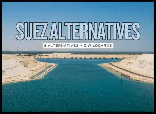
The Suez Canal is both a lifeline and a financial burden. A single transit for a fully laden ultra-large container ship can top $700,000, a figure that makes even the most seasoned operators wince. With costs climbing and global trade lanes under constant pressure, the question becomes inevitable: what alternatives exist and are any of them truly viable?
At Ship Universe, we’ve built a Canal Cost Estimator to help you put real numbers on the table. But numbers only tell part of the story. In this report, we’ll explore the top five realistic Suez Canal alternatives under discussion today, from Arctic shortcuts to ambitious multimodal land bridges and assess what they might mean for shipowners over the next decade.
1️⃣ Northern Sea Route (Arctic)
When the Arctic cooperates, the map redraws itself. The Northern Sea Route (NSR) can shave a big chunk off Asia–Europe distance, but it trades canal tolls for seasonal ice risk, permits, ice-class/escort costs, and insurance uncertainty. For most owners, it’s a niche lever, useful in specific months, with specific vessels and cargos, under tight operational control.
✅ Advantages
30–40% shorter distance vs. Suez
Lower bunker consumption & emissions
No canal tolls or congestion delays
Potential long-term strategic trade lane
⚠️ Drawbacks
Seasonal navigation window (mainly summer/autumn)
High insurance premiums due to risk
Ice-class ship requirements & escort fees
Geopolitical and sanctions risk
Northern Sea Route (Arctic)
Factor
Details
Impact on Stakeholders
Distance Savings
Up to 3,000–3,500 nm shorter between Asia and Europe
Cuts 10–12 days off voyages; major bunker savings when fuel prices are high
Seasonal Window
Primarily July–October during ice melt period
Unreliable for year-round liner schedules; mostly viable for tramp trades
Ice-Class/Support
Ice-class vessels or Russian icebreaker escort required
Capital-intensive ship specs or recurring escort fees; affects ROI
Insurance & Risk
High premiums; reinsurers cautious about Arctic liability
May wipe out fuel savings; only justified if rates are extremely favorable
Geopolitical Climate
Controlled by Russia; sanctions and security considerations apply
Western carriers hesitant; risk of sudden regulatory shifts
Cargo Suitability
Best for bulk, tankers, and select container trades
Time-sensitive liner cargo less viable; bulkers benefit more
Environmental Impact
Lower CO₂ per voyage; higher local Arctic pollution risks
Potential ESG upside if carbon pricing intensifies; scrutiny on Arctic ecosystems
Infrastructure Readiness
Sparse ports, limited SAR (search and rescue), developing bunkering facilities
Operational exposure; less flexibility if breakdowns occur
Note: Data and estimates are based on currently available industry sources. Conditions, costs, and risks may change.
2️⃣ International North–South Transport Corridor (INSTC)
Think of the INSTC as a rail-and-sea shortcut stitched together through India, Iran, the Caspian, and Russia up into Europe. On paper, it promises to cut shipping costs by 30% and time by 40% compared to the Suez-centric route. In practice, it’s a patchwork of rail links, feeder ships, and customs checkpoints that can frustrate operators. For stakeholders, it’s less about sending entire fleets this way and more about spotting opportunities: certain cargos, lanes, and partnerships that make the corridor viable when Suez fees or delays bite hardest.
✅ Advantages
Bypasses Suez; potential 20–40% time savings on certain lanes
Competitive for specific cargos (project, high-value, perishables with reliable rail legs)
Diversification benefits during Red Sea disruptions
Growing investment along the route (ports, rail, dry ports, customs digitization)
⚠️ Drawbacks
Multimodal handoffs add complexity, delay risk, and admin cost
Sanctions/geopolitics can impact insurance, payments, and routing
Capacity is maturing; not a one-to-one Suez replacement
Documentation & customs variability; requires seasoned local partners
International North–South Transport Corridor (INSTC)
Factor
Details
Impact on Stakeholders
Core Geometry
Sea (India) → Ports in Iran → Rail to Caspian → Short-sea across Caspian → Rail via Russia to Europe (and vice versa)
Multimodal chain replaces single-ocean passage; requires tight orchestration across operators
Time & Distance
Modelled reductions of ~20–40% vs. Suez-centric lanes (route- and terminal-dependent)
Potential lead-time wins on select O/D pairs; sensitive to border dwell and handoff efficiency
Commodities with tighter delivery windows or Suez-sensitive cost structures benefit most
Sanctions & Geopolitics
Exposure to Iran/Russia-related sanctions, banking/FX constraints, and policy shifts
Requires rigorous compliance screening, sanction-safe banks, and contingency routings
Insurance & Liability
Mixed marine/rail liability regimes; cargo insurance riders for multimodal segments; P&I considerations for feeder legs
Work with brokers versed in corridor risks; ensure proper through-coverage and claim pathways
Infrastructure Readiness
Upgrades underway at key ports (e.g., Chabahar/Bandar Abbas), dry ports, rail links, and Caspian ferry/ro-ro capacity
Performance improving but uneven; pilot runs with vetted partners reduce ramp-up risk
Documentation & Customs
Transit visas, TIR carnets where applicable, e-doc adoption varies; potential for single-window pilots
Local expertise is decisive; pre-clearance and standardized data exchange cut dwell time
Digital Visibility
Tracking across rail/marine legs, interoperable EDI, milestone capture, exception alerts
Essential for reliability; choose operators with API-ready visibility stacks
Scalability & Capacity
Not Suez-scale; corridor growth depends on rail slots, rolling stock, and Caspian lift
Best used as a portfolio lane—supplement, not replacement, for ocean mainlines
ESG & Emissions
Rail legs can lower CO₂ per unit vs. long ocean detours; depends on energy mix and dwell
Potential carbon advantage on select O/Ds; validate with corridor-specific emission factors
Note: Corridor performance, costs, and legal exposure vary by operator, season, and policy environment. Validate assumptions with current corridor quotes, compliance counsel, and on-the-ground partners before committing volume.
3️⃣ Middle Corridor / TITR (Trans-Caspian via KZ–AZ–GE–TR)
The Middle Corridor, also known as the Trans-Caspian International Transport Route (TITR), threads cargo from Central Asia through Kazakhstan, across the Caspian Sea, into Azerbaijan, Georgia, and onward to Turkey and Europe. It’s marketed as a geopolitical hedge, bypassing both Russia and the Suez Canal. For stakeholders, it’s still an emerging path: stronger than a concept, weaker than a mainline, but one to watch as investment builds momentum in ports, rail, and digital customs systems.
Currently higher than ocean Suez runs; competitiveness improves if canal tolls rise or delays intensify
Capacity & Scalability
Limited Caspian ferry slots; regional rail upgrades underway but not yet high-volume
Best suited for targeted volumes or strategic cargos, not mass container flows yet
Geopolitics
Promoted by EU, China, Central Asian states; avoids Russian territory
Strategic hedge; reduces exposure to Russia but introduces regional political variability
Cargo Suitability
Project cargo, bulk commodities, automotive, machinery, and containers in niche trades
Flexible mix but volumes constrained by infrastructure bottlenecks
Customs & Borders
Processes differ by state; harmonization efforts in progress; e-platform pilots underway
Stakeholders must leverage local agents and digital tools to avoid costly delays
Digital Visibility
Progress toward interoperable tracking and EDI; gaps remain in ferry legs
End-to-end visibility still patchy; partner selection critical
ESG & Emissions
Rail reduces emissions vs. long ocean detours; Caspian ferries add variability
Potential ESG upside; depends on clean energy adoption across rail segments
Note: The Middle Corridor is evolving quickly with new investments and political support, but costs, reliability, and capacity remain fluid. Stakeholders should treat it as a diversification tool rather than a core replacement for Suez at this stage.
The India–Middle East–Europe Economic Corridor (IMEC) is a high-profile initiative announced at the 2023 G20 summit, linking Indian ports to the Gulf by sea, then across the Arabian Peninsula by rail, and onward by sea again through the Mediterranean to Europe. Unlike speculative canal projects, IMEC is designed as a trade bridge that integrates modern rail, ports, and digital platforms. For stakeholders, it’s a long-term bet: still in planning stages, but if realized, it could shift trade patterns, cut fuel and time on India–Europe lanes, and provide an alternative to Suez bottlenecks.
✅ Advantages
Official multilateral backing (India, EU, U.S., Gulf states)
Designed for speed: integrated rail + ports + digital customs
Could lower costs and transit time for India–Europe trade
Diversifies away from Suez reliance, adds resilience to supply chains
⚠️ Drawbacks
Still a proposal—construction, funding, and geopolitics will shape timelines
If executed, offers smoother visibility than current multimodal corridors
Note: IMEC is still in its early planning phase. Project timelines, funding commitments, and security considerations may alter feasibility. Stakeholders should treat IMEC as a long-term strategic option rather than an immediate routing alternative.
Iraq’s “Development Road”, often dubbed the “Dry Canal”, envisions a land-based freight artery from the strategically positioned Grand Faw Port, across Iraq, and into Türkiye. It’s a bold infrastructural pivot aiming to bridge Middle Eastern manufacturing hubs with European markets while bypassing Suez dependency. For stakeholders, this emerges less as a maritime alternative and more as a trade-landscape reshaper: a chance to tap inland corridors, diversify routes, and align with regional redevelopment momentum.
✅ Advantages
Bypasses congested waterway chokepoints like Suez
Leverages Iraq’s geographic position as a Gulf-Europe corridor
Backed by development financing and regional strategic plans
Potential hub for Gulf exports and regional trade redistribution
⚠️ Drawbacks
Still early-stage: feasibility, funding, and route planning ongoing
Iraq’s infrastructure and security context remain unstable
Cross-border alignment with Türkiye and customs harmonization needed
Not a maritime alternative—requires inland logistics capabilities
Iraq’s “Development Road” / “Dry Canal”
Factor
Details
Impact on Stakeholders
Route Layout
Grand Faw Port → Inland rail/road corridor across Iraq → Border crossing → Connection to Türkiye and onward to Europe
Transforms Iraq into a Gulf–Europe freight hub; requires robust inland integration
Development Stage
Project in planning/preliminary tender stages; select firms shortlisted as of late 2024
High uncertainty on timeline, investment, and routing—early-stage strategic monitoring advised
Infrastructure Needs
Requires construction/upgrading of roads, rail, dry ports, customs hubs, and security zones
Stakeholders must map inland logistics capacity and partner with trustworthy developers
Security & Stability
Iraq contends with insurgency, political volatility, and infrastructure fragility
Risk-adjusted modeling essential; security premiums likely high
Cross-Border Coordination
Customs alignment, border infrastructure, and bilateral agreements with Türkiye required
Untested border chain may generate delays unless pre-cleared and digitally integrated
No commercial benchmarks yet; early pilots needed for rate discovery
Cargo Suitability
Best for Gulf exports (e.g., hydrocarbons, solids, project freight) destined for Europe
Targeted niche lanes may benefit; mass container flows speculative
Political & Development Backing
Backed by national development plans; firms shortlisted for port ops as of 2024
Political will is a positive, but execution risks remain; monitoring needed
ESG & Sustainability
Inland routing may reduce sea emissions, but inland footprint and security impact must be assessed
Stakeholders should include ESG risk reviews as part of corridor assessments
Note: The “Development Road” is a concept under preliminary development. Its feasibility depends on Iraq’s political stability, funding execution, and logistics capability. Stakeholders should approach it as a long-term strategic option and engage early for project updates and pilot opportunities.
🃏 Wild Cards: Mega-Projects to Watch
These concepts won’t replace Suez soon, but they’re strategic signals worth monitoring. If any advance, they could reshape bargaining power, regional flows, and long-horizon network design.
🏗️ Ben Gurion Canal (Israel)
Sea-to-Sea canal concept from the Red Sea (Eilat) to the Mediterranean across Israel’s Negev.
What it is: Dual-lane, deep canal proposal enabling two-way traffic for large vessels.
Potential: A true maritime bypass of Suez, potentially higher capacity if built.
Biggest hurdles: Geopolitics, capital intensity, environmental and social impact reviews.
Status snapshot: Conceptual/vision stage; no construction start.
Type: CanalReplacement potential: High (if built)Risk: Extreme
🌍 Eurasia Canal (Caspian → Black Sea)
Proposed waterway through the Kuma-Manych corridor to link the Caspian with the Black Sea.
What it is: New navigable canal enabling Caspian states direct sea access to Europe.
Potential: Could boost Central Asian exports and diversify away from existing chokepoints.
Biggest hurdles: Cost, environmental permitting, multi-state coordination, long build time.
Status snapshot: Periodically studied/discussed; no execution phase.
Type: CanalReplacement potential: Medium (regional)Risk: High
🏞️ Iranrud (Caspian ↔ Persian Gulf)
Historic idea to connect the Caspian Sea to the Persian Gulf via an inland canal across Iran.
What it is: North–south inland canal concept with alternative alignments studied over decades.
Potential: Would bypass Suez and Turkish straits for Caspian trade flows.
Biggest hurdles: Terrain, water sourcing, environmental impact, sanctions, financing.
Status snapshot: Conceptual; no active construction program.
Type: CanalReplacement potential: Medium (regional)Risk: Extreme
Wild Cards — Quick Comparison
Project
What It Is
Replacement Potential
Realistic Timeline
Primary Risks
Ben Gurion Canal
Israel Red Sea–Med sea-to-sea canal concept
High (if ever built)
Long-term (uncertain)
Geopolitics, capex, environment, social license
Eurasia Canal
Caspian–Black Sea canal through Russia
Medium (regional)
Long-term (uncertain)
Cost, coordination, environmental approvals
Iranrud
Caspian–Persian Gulf inland canal in Iran
Medium (regional)
Long-term (uncertain)
Terrain, water, sanctions, financing, environment
Note: These projects are conceptual or early-stage. Feasibility, costs, timelines, and political support are highly uncertain. Stakeholders should treat them as horizon scanning items, not routing assumptions.