China Expands Ocean Mapping Along Future Submarine Lanes
China is carrying out an extensive undersea mapping and monitoring effort across the Pacific, Indian, and Arctic oceans using a large network of research vessels, seabed surveys, and underwater sensors in waters tied to potential future submarine operations. Reporting published on March 24 says Chinese survey ships have spent the last two years tracing waters near Taiwan, Guam, Japan, the Philippines, Hawaii, the Malacca Strait, and parts of the Indian Ocean, gathering bathymetric, hydrographic, and environmental data that naval specialists say can be used to improve submarine navigation, concealment, and anti-submarine detection. The reporting identifies the Ocean University of China research vessel Dong Fang Hong 3 as one example, describing repeated survey patterns near Taiwan and Guam and later in the eastern Indian Ocean, while expert testimony and naval analysis describe the wider effort as part of China’s larger undersea sensing buildout and civil-military fusion strategy.
Click here for 30 second summary of the full piece ▶
China’s survey fleet is mapping the seabed along future submarine operating routes
Reporting published on March 24 says China is running a broad undersea mapping and monitoring effort across the Pacific, Indian, and Arctic oceans using dozens of research vessels and underwater sensors. The activity has included repeated survey work near Taiwan, Guam, Japan, the Philippines, Hawaii, and the approaches to the Malacca Strait, while naval analysts and intelligence testimony say the resulting data can support submarine navigation, concealment, sonar performance, and anti-submarine detection.
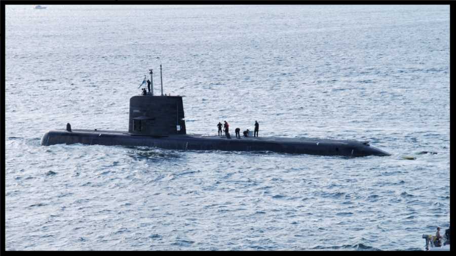
- Survey scale: Reuters reviewed five years of movement by 42 research vessels active across the Pacific, Indian, or Arctic oceans.
- Named example: Dong Fang Hong 3 was tracked near Taiwan, Guam, Japan, and the Indian Ocean during 2024 and 2025.
- Military linkage: naval experts and U.S. testimony tie the surveys to submarine operations, seabed sensors, and a wider undersea sensing architecture.
| Survey bucket | Confirmed development | Geographic focus | Military relevance | Signals to watch next |
|---|---|---|---|---|
| Scale of activity | Reporting published on March 24 says China is conducting a vast undersea mapping and monitoring operation using dozens of research vessels and hundreds of sensors. Large survey network | Pacific, Indian, and Arctic oceans. | Detailed seabed and water-column knowledge can improve submarine routing, concealment, sonar performance, and anti-submarine search planning. | Whether survey density grows further in chokepoints and around allied bases, and whether more civilian vessels are linked to persistent undersea sensing work. |
| Named vessel example |
The Ocean University of China research vessel Dong Fang Hong 3 was reported to have spent 2024 and 2025 operating near Taiwan, Guam, Japan, and the Indian Ocean, including repeated patterns associated with mapping and sensor-check work.
The vessel also moved across the waters between Sri Lanka and Indonesia near approaches to the Malacca Strait.
Tracked survey platform
|
Waters near Taiwan, Guam, Japan, and the eastern Indian Ocean. | These are areas through which U.S. and allied submarines would likely move in a regional contingency, making local terrain and acoustic knowledge strategically valuable. | Additional voyages by the same platform, more sensor tending near Japan and Guam, and whether similar tracks appear around allied submarine transit routes. |
| First Island Chain and western Pacific |
The survey pattern is concentrated around the Philippines, east of Japan, near Taiwan, and around Guam and Hawaii.
These waters align with the First Island Chain and major U.S. and allied operating areas in the Pacific.
Pacific battlespace mapping
|
Philippines, Guam, Hawaii, waters near Japan and Taiwan. | Naval analysts say this type of data helps define the undersea battlespace and can support both Chinese submarine operations and efforts to detect rival submarines. | More survey traffic east of the Philippines, around Guam, and in the channels submarines would use to enter or leave the South China Sea. |
| Indian Ocean extension |
Chinese survey tracks and related documents describe activity around the Ninety East Ridge and across parts of the Indian Ocean approaching the Malacca Strait.
This extends the effort beyond near seas and into routes tied to China’s energy lifelines and future far-seas naval movement.
Far-seas preparation
|
Indian Ocean, Sri Lanka approaches, Ninety East Ridge, Malacca approaches. | Undersea mapping in these waters can support longer-range submarine operations and improve awareness along routes critical to Chinese trade and wartime movement. | Whether more Chinese research ships appear near Indian Ocean chokepoints and allied naval access points. |
| Sensor architecture |
U.S. intelligence testimony and naval analysis describe China building layered undersea sensing systems that gather water temperature, salinity, currents, and subsea-movement data.
The effort is often described using ideas such as a more “transparent” ocean or an integrated maritime sensing architecture.
From maps to sensing grid
|
South China Sea, western Pacific, Indian Ocean, sensor lines near Japan, the Philippines, and Guam. | Static and mobile sensors can improve submarine detection, sonar optimization, and long-duration maritime awareness beyond one-time survey cruises. | Expansion of seabed sensors, gliders, UUV deployments, and more links between civilian oceanography and military undersea surveillance. |
| Civil-military integration |
The reporting and expert testimony both connect the survey effort to China’s civil-military fusion model, in which civilian scientific activity and military applications are closely linked.
Naval analysis submitted to the U.S.-China Economic and Security Review Commission describes civilian bathymetric mapping as helping guide future submarine operations.
Dual-use engine
|
State entities, research institutes, universities, and military-linked undersea programs. | Civilian oceanography gives China a larger and more deniable data-gathering base than a purely military survey fleet alone. | New research-vessel construction, deeper ties between universities and naval projects, and greater overlap between scientific expeditions and militarily important waters. |
Ocean-floor mapping matters most when it is not isolated. Bathymetry becomes more operationally valuable when it overlaps with key submarine routes, when it is reinforced by salinity and current data, when fixed or drifting sensors remain in the water, and when a civilian survey fleet can repeatedly revisit the same areas. This tool turns that pattern into a practical undersea-readiness gauge.
Detailed seabed information helps submarines maneuver more safely, hide better, and understand how local topography affects sonar and tracking.
Survey cruises become more strategically powerful when they support seabed sensors, buoys, gliders, and repeat monitoring instead of one-time data collection.
A large civilian research fleet gives undersea data collection more reach, more revisit capacity, and more political cover than a purely naval fleet alone.
We welcome your feedback, suggestions, corrections, and ideas for enhancements. Please click here to get in touch.