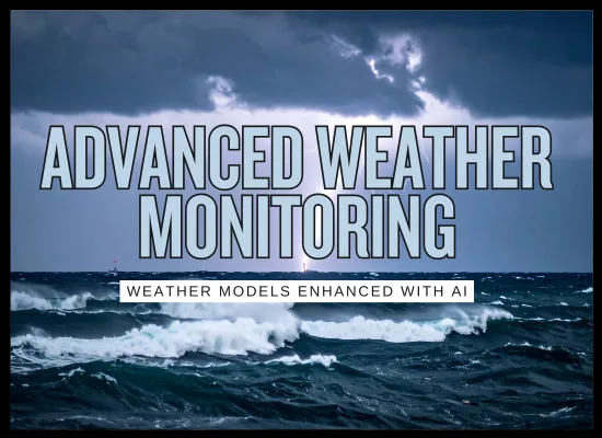
Advanced AI Weather Monitoring: 2026 Guide

Advanced AI weather monitoring is the new baseline for voyage planning in 2026 because the forecast “engine room” is changing fast: traditional physics models are now being run alongside operational AI forecast systems, and shipping-facing providers are plugging AI models into their routing and alert stacks.

🌦️

What is it and Keep it Simple...

Advanced AI weather monitoring is a voyage decision layer that blends multiple forecast sources, ocean and wave models, and ship context to answer a simple question: what weather and sea state will matter to this ship on this route, and when.

The 2026 shift is that AI is no longer just a buzzword. Forecast centers and providers are running AI forecast systems alongside physics-based models, then feeding those outputs into shipping tools for routing, alerts, and arrival planning.

In plain terms
Think of it as a smarter weather feed that is tuned for shipping. It does not just show wind and waves. It turns forecasts into voyage decisions: speed, track, timing, and risk thresholds.
What AI changes
AI models can produce fast, high-skill forecast guidance and help improve short-range detail when combined with traditional models. The practical result is better time-to-decision and more frequent refresh cycles for routing and alerts.
What the bridge sees
Cleaner risk cues: avoid this band of seas, delay this turn window, slow down here to reduce slamming, or adjust arrival time to avoid the worst segment.
Where it is strongest
Tropical cyclone track uncertainty management, winter storm routing, strong-current corridors, and coastal approaches where timing and sea state drive safe speed decisions.
What you are really buying
  • A multi-model forecast stack that updates often and highlights uncertainty
  • Routing outputs that translate weather into speed and track choices
  • Alerting rules that match vessel limits and your operating policy
  • A workflow that keeps ship and shore aligned on the same forecast picture
Advanced AI weather monitoring: solution types on the market
Solution type Advantages Disadvantages Cost and install reality
AI plus physics forecast stack
Multi-model, frequent updates, uncertainty-aware
Fast refresh Ensembles Better guidance
  • Faster forecast generation supports more reroutes and better timing decisions
  • Ensemble views reduce false confidence by showing spread and risk windows
  • Improves decision lead time for storm track management and wave avoidance
  • AI outputs still require guardrails for rare extremes and unusual conditions
  • Model differences can confuse users if the UI does not explain uncertainty clearly
  • Confidence can be overstated if you only show a single deterministic line
  • Usually bundled inside weather providers, routing systems, or voyage optimization subscriptions
  • Little onboard hardware required, but bandwidth and display workflow matter
  • Biggest setup cost is policy: limits, thresholds, and who has authority to change track
Ship routing and voyage optimization
Route, speed, and arrival planning tied to conditions
Fuel and safety Arrival planning Decision workflow
  • Translates weather into track and speed tradeoffs crews can execute
  • Supports time of arrival planning to reduce waiting and avoid rough segments
  • Creates a repeatable ship shore loop for route changes and approvals
  • Bad vessel performance inputs lead to bad recommendations
  • Optimizing only for fuel can create comfort or safety issues if limits are weak
  • Local effects near coasts can be missed without high-resolution inputs
  • Mostly software plus integration into onboard ECDIS or planning workflow
  • Implementation effort is training and procedure alignment more than installation
  • Expect a rollout phase to tune alert limits and route change governance
High-resolution coastal nowcasting
Short-term wind, squalls, sea state near terminals and straits
Port approaches Short-range Higher detail
  • Better decision support for pilot boarding windows and coastal leg risk
  • Improves handling of fast-changing convective weather and gust fronts
  • More useful than global models for narrow waterways and approach legs
  • Coverage and quality vary widely by coastline and data density
  • Can increase alert fatigue if thresholds are not tuned
  • Short-range accuracy can still be limited in complex terrain or sparse data areas
  • Often an add-on service for key ports or regions, not global coverage
  • May need local data feeds, radar assimilation, or port weather sharing
  • Best value when paired with clear port delay and safety decision rules
Ocean current and wave intelligence
Surface currents, swell direction, wave period, and risk zones
Ride the currents Avoid bad seas Stability support
  • Supports route choices that avoid slamming and reduce speed loss
  • Improves planning in strong current corridors and seasonal patterns
  • Useful for fuel planning and safety on long legs
  • Errors in currents or wave timing can mislead if treated as exact
  • Local bathymetry and coastal effects can degrade general models
  • Needs proper display to avoid clutter on the bridge
  • Typically a subscription layer included with routing tools or providers
  • Highest value when fused with vessel limits and historical speed loss patterns
  • Requires user training on wave period, not just wave height
Storm and lightning alerting
Convective hazards, squall lines, and rapid intensification cues
Fast alerts Routing trigger Crew awareness
  • Improves short-notice hazard awareness for deck operations and approach legs
  • Can provide early cues for storm development and risk windows
  • Works well as a trigger to re-check route and speed plan
  • Too many alerts becomes noise and gets ignored
  • False positives can cause unnecessary slowdowns without clear rules
  • May not explain uncertainty well unless designed for operators
  • Low install effort if delivered via provider platform or onboard app
  • Value depends on alert policy: what changes, who approves, what is logged
  • Works best with limits by operation type: cargo work, mooring, crane ops
Edge delivery and low-bandwidth mode
Caching, compressing, and prioritizing what matters at sea
At-sea reliability Fewer dropouts Faster UX
  • Improves usability when connectivity is weak or expensive
  • Prioritizes critical layers and reduces data overload
  • Enables more consistent ship shore alignment
  • Risk of stale data if update rules are unclear
  • Users may not notice they are viewing older layers
  • Requires careful configuration of refresh and alert triggers
  • Usually a configuration feature, not a major hardware purchase
  • Best paired with clear timestamps and freshness indicators on every panel
  • Implementation cost is mostly IT and procedure setup
Simple buying shortcut: if the product cannot show uncertainty, timestamps, and a clear route decision workflow, it will not scale across a fleet. In 2026, the winners are the tools that turn forecasts into decisions without flooding the bridge with layers.
🧪

Advanced AI weather monitoring: what is really working

1) Fewer last-minute route changes
Shore teams are getting better outcomes when the routing plan is updated earlier, not in the final hours. If your process still waits until seas are already building, the tech will look weak.
2) Uncertainty is shown clearly
The best tools do not pretend the forecast is a single perfect line. They show spread, timing windows, and confidence, then translate that into a practical decision range.
3) Limits are vessel-specific
Real programs configure limits by ship type and condition. That includes slamming risk, green water risk, cargo sensitivity, and operations that should stop at certain thresholds.
4) One shared picture for ship and shore
Where it works, the bridge and the office see the same forecast stack and route rationale, with timestamps. This reduces back-and-forth and prevents “two different forecasts” arguments.
5) Alerts trigger a decision, not more noise
The best setups have fewer alerts, but they matter. Each alert is tied to a specific action: review track, adjust speed plan, shift waypoint timing, or hold an operation.
Fast test in 60 seconds
Pull the last 10 weather-related slowdowns or re-routes and ask: Did the tool warn early enough, did the crew trust it, and did it change the decision. If the answer is yes on most cases, it is working.
Weather disruption ROI tool (slowdowns, extra fuel, schedule cost)
If you prefer, use trips per vessel-year for one ship.
Include speed reductions, diversions, and waiting driven by weather and sea state.
Use 0 if slowdowns reduce burn. Use a small number if reroutes add fuel.
Used only for the extra fuel estimate above.
Schedule knock-on, berth window misses, off-hire risk, overtime, penalties.
Conservative range: 5 to 30 percent. This is better timing and fewer avoidable hits.
Subscription plus any weather routing module cost.

Baseline annual schedule cost

$0

Baseline annual extra fuel cost

$0

Baseline annual disruption cost

$0

Estimated annual savings

$0

Net annual benefit (after tool cost)

$0

Payback (months)

n/a

This is a sensitivity tool. The cleanest ROI cases usually come from fewer schedule hits and fewer avoidable heavy-weather segments. Keep the reduction percent conservative unless you can point to repeatable decisions that improved outcomes.

If you keep the workflow simple, this category tends to pay for itself through fewer schedule hits, fewer avoidable heavy-weather segments, and less back-and-forth between bridge and shore about which forecast to trust. The tools only look impressive when the operating policy is clear about limits, decision authority, and how route changes are documented.

We welcome your feedback, suggestions, corrections, and ideas for enhancements. Please click here to get in touch.
By the ShipUniverse Editorial Team — About Us | Contact