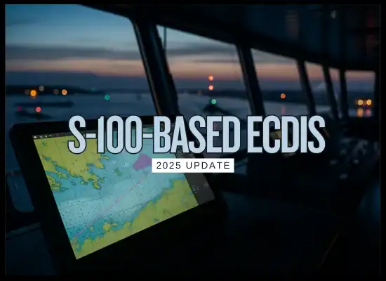
HomeTransition to S-100-based ECDIS Made Simple: 2025 Update
Transition to S-100-based ECDIS Made Simple: 2025 Update
September 4, 2025
Paper charts became pixels. Now those pixels get smarter. S-100-based ECDIS turns today’s map view into a layered data canvas, so crews can see official ENCs alongside high-resolution bathymetry, real-time water levels, currents, and navigational warnings in one place. From January 1, 2026 ships may use S-100 ECDIS, and from January 1, 2029 all new ECDIS installations must meet the new performance standards.
🧪 What is it and Keep it Simple...
Think of S-100 ECDIS like turning your chart display into a smartphone. The basic map is still there, but now you can add official “apps” that drop live layers on top, so the picture gets clearer and smarter without changing how you steer.
The base:S-101 ENCs become the main chart layer, replacing S-57.
Plug-in layers:S-102 high-res depth, S-104 water level, S-111 surface currents, S-124 nav warnings, S-129 under-keel clearance, and more.
How it runs today: “Dual fuel” ECDIS can show S-57 and S-100 products side by side during the transition.
Why owners care: clearer situational awareness, cleaner route checks, and a standards path that fits upcoming IMO performance rules.
Easy next step: ask for an S-100-capable, dual-fuel ECDIS and confirm the first S-100 layers you want supported.
Transition to S-100-based ECDIS — Advantages and Disadvantages
Category
Advantages
Disadvantages
Notes / Considerations
Navigator experience
Cleaner symbology, smarter query of features, consistent layer controls
UI differs by maker; risk of confusion during changeover
Aim for similar look and feel across bridge equipment where possible
Situational awareness
High resolution depth and real time data layers improve the picture
Too many layers can clutter the display
Create bridge presets for harbor, coastal, and ocean passages
Data layers
Add S-101 base charts with S-102 depth, S-104 water level, S-111 currents, S-124 warnings, S-129 under keel clearance
Coverage will not be uniform at first; update cycles vary by office
Map your trade routes against available S-100 products and refresh rates
Alerts and validation
Improved machine checks for route and safety contours
New alert logic needs tuning to avoid nuisance alarms
Test routes in simulator and record alarm behavior by scenario
Route planning and UKC
Layered data supports dynamic under keel clearance and tide informed planning
Benefits depend on quality of local S-100 data and sensor inputs
Agree ship specific UKC policy and verify with pilots and ports
Integration
Standardized formats ease links to PPU, VTS, weather, and voyage tools
Legacy interfaces and shore workflows may need updates
Check ECDIS APIs, file exchange, and cyber controls before rollout
Hardware and performance
Modern processors handle heavy layers and larger datasets
Older units can lag with multi layer rendering
Confirm CPU, RAM, storage, graphics, and display resolution during upgrade
Training and change management
Structured type specific training reduces error and speeds adoption
Bridge teams need time to adapt and rebuild muscle memory
Plan short modules: new layers, alerts, route checks, and incident drills
Compliance and timelines
Aligned with IMO performance standards for new systems
Mixed fleets face staggered upgrades and document control
Keep clear records for audits and flag state inspections
Cost and ROI
Fewer deviations and cleaner port approaches can save fuel and time
Licenses, data subscriptions, and refits add up
Bundle upgrades with survey windows and negotiate data plans by route
Cyber and resilience
Defined data models support validation and secure update paths
More data sources mean more attack surface if unmanaged
Harden networks, control media, and maintain an ECDIS fallback plan
Migration strategy
Dual running lets crews compare S-57 and S-100 during real voyages
Parallel procedures can be confusing without clear SOPs
Publish a deck of bridge checklists for before, during, and after the switch
Summary: S-100 makes ECDIS a layered data system. The gains come from better depth, tides, currents, and warnings in one place. Success depends on crew training, reliable data supply, careful alert tuning, and a staged migration plan.
⚗️ 2025 S-100 ECDIS Rundown
Status today: The global S-100 standard is published and in force. Hydrographic offices are issuing early S-100 data sets in selected areas, with broader rollout starting 2026.
When you can use it: S-100 ECDIS can be used from 1 January 2026. From 1 January 2029 all new ECDIS installations must meet the S-100 performance standards.
How ships run it now: “Dual-fuel” operation lets bridge teams view S-57 charts and S-100 products side by side during the transition.
What layers are real: S-101 ENCs are the new base. S-102 high-resolution bathymetry, S-124 navigational warnings, S-111 surface currents and others are available or entering service in growing coverage.
What it changes on watch: Clearer layers and smarter checks for route, tides, currents and under-keel clearance, with less screen clutter when presets are used.
Owner action now: Specify S-100-capable, dual-fuel ECDIS. Check S-100 coverage on your main routes, plan type-specific training, and set simple bridge presets for harbor, coastal and ocean modes.
🧮 S-100 ECDIS — ROI, Payback & NPV
Estimate the business case for upgrading to S-100-capable, dual-fuel ECDIS (S-57 + S-100). Use a preset or edit inputs.