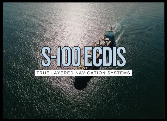
HomeS-100 ECDIS (Layered Charts) Made Simple: 2026 Update
S-100 ECDIS (Layered Charts) Made Simple: 2026 Update
December 26, 2025
S-100 ECDIS is the shift from “one electronic chart” to a layered navigation system. Instead of a single chart dataset trying to do everything, S-100 lets the ship run a base ENC and then switch on extra layers like high-resolution depth grids, dynamic water levels, surface currents, navigational warnings, and under-keel clearance outputs. The practical impact is better planning in tight water, fewer last-minute route edits, and a clearer bridge picture when the crew uses simple presets instead of turning on every layer at once.
🧭
What is it and Keep it Simple...
S-100 ECDIS is like upgrading from a static road map to a navigation app with optional layers.
The base chart becomes S-101 (the next generation ENC), and you can add extra “overlays” when they exist for your area.
The most talked-about layers are:
S-102 (high-resolution bathymetry grids),
S-104 (water level surfaces),
S-111 (surface currents),
S-124 (navigational warnings),
and S-129 (under-keel clearance management outputs).
Crews should not run everything all the time. The smart approach is simple presets: harbor, coastal, ocean.
In plain terms
S-57 was “one ENC format.” S-100 is a framework that lets ECDIS show multiple standardized data products together,
using defined interoperability rules so layers do not clash or confuse.
Why 2026 matters
From 1 January 2026, S-100 ECDIS can be used under the updated IMO performance standards, with a transition period until 1 January 2029
when new ECDIS installations are expected to comply with the updated S-100 performance standard.
What you are really buying
An ECDIS that can run S-101 plus selected S-100 layers without clutter
Route checks that use richer depth, water level, and current inputs where available
A training and preset plan that keeps the bridge picture simple and consistent
S-100 ECDIS: Advantages and Disadvantages
Category
Advantages
Disadvantages
Notes / Considerations
Navigator experience
Cleaner portrayal options and better feature structure can improve “find what matters” on the bridge.
Different makers will present layers and controls differently, which increases changeover risk.
Build presets for each phase of voyage and train crews on that exact ECDIS type.
Situational awareness
Layered depth, water level, currents and warnings can create a more accurate picture on constrained approaches.
Too many layers can clutter fast and slow down scanning and decision-making.
“Less is more.” Use only the layers that directly support the next decision.
Data coverage reality
When coverage exists, S-102 and S-104 can materially improve tide-sensitive planning.
Coverage and update cadence vary by region and hydrographic office, especially in early rollouts.
Map your trade lanes and ports against what S-100 products are actually available today.
Route checks and alerts
Better inputs can improve route validation, safety contours, and “what changed” awareness.
New alert logic can produce nuisance alarms if thresholds are not tuned to vessel and trade.
Test typical routes and port approaches and adjust alert filters before fleet rollout.
UKC and tide windows
Under-keel clearance outputs and dynamic water level layers can support more disciplined “go or no-go” planning.
Benefits depend on trustworthy local data and how well the vessel’s parameters are handled in the workflow.
Align UKC policy with pilots and ports and document assumptions (draft, squat, margins).
Integration with shore and pilots
Standardized products improve the chance of consistent sharing between ship, pilot tools, and shore voyage systems.
Mixed fleets and mixed shore tools can create “format mismatch” headaches during transition.
Confirm file exchange, approval workflows, and retention of evidence packs.
Hardware and performance
Newer ECDIS hardware is better suited to multi-layer data handling and rendering.
Older consoles can lag or stutter if heavy layers are used.
Validate CPU, RAM, storage, and display performance during acceptance tests.
Training and change management
Proper, type-specific training reduces confusion and helps crews use layers safely.
Crews need time to rebuild muscle memory and bridge team routines.
Keep training short and practical: presets, route checks, alert tuning, drills.
Compliance timeline
A phased transition supports gradual adoption and “dual running” comparisons.
Mixed fleets can end up with multiple ECDIS generations at once, complicating procedures and document control.
Plan around key dates: 1 Jan 2026 voluntary use, 1 Jan 2029 new installations expected to meet updated S-100 performance standards.
Cyber and resilience
More structured data products can support validation and better update control when managed properly.
More sources and connections can expand the attack surface if networks and procedures are weak.
Treat ECDIS updates and data distribution as part of OT cyber management and fallback planning.
Summary: S-100 turns ECDIS into a layered data system. The upside is better depth, water level, currents and warnings in one place when coverage exists.
The downside is clutter risk, uneven regional product availability, and the need for disciplined presets, tuned alerts, and type-specific training.
🧪
2026 S-100 ECDIS: What’s Really Working
1) “Dual viewing” is the practical bridge reality
The smoothest rollouts let crews keep the familiar S-57 workflows while selectively turning on S-100 layers where they add value.
Owners that force an “all at once” switch usually create clutter and training friction.
2) Presets beat “more layers” every time
Harbor, coastal, ocean presets keep scanning simple. The win is not more data on screen.
The win is fewer late route edits and fewer “why is the display yelling at us” moments.
3) The best early value comes from constrained water
High-resolution depth and dynamic water level type products matter most where UKC, squat margins, and tidal windows drive decisions.
If your trades are mostly deep water, the ROI case is more about future-proofing and standardization.
4) Route check logic improves only if inputs are disciplined
Owners seeing benefits have a clear route planning workflow: approved parameters, consistent safety settings, and documented thresholds.
Without that, better data does not stop bad assumptions.
5) Evidence is becoming a fleet KPI
Working programs track simple evidence metrics: number of late route edits, nuisance alerts per transit, UKC “surprises,”
and time spent re-checking passages before pilot boarding.
6) The blockers are predictable
Patchy coverage of some S-100 products, mixed hardware performance on older consoles, and training that is too generic.
The fix is route-by-route product planning, hardware acceptance testing, and type-specific modules.
Fast “is it working” test
If your bridge teams can (a) run clean presets, (b) explain why each layer is on, and (c) show fewer last-minute route edits on tide-sensitive legs,
then it is working. If the screen is cluttered and alarms are constant, it is not working yet.
Start conservative: set hours-saved low and keep caps tight
Baseline and Finance
Effect Caps (to keep it realistic)
Upgrade Costs and Expected Effects
Assumed Annual Effects (edit to fit your routes)
One-time CAPEX
—
Annual OPEX (data + maint)
—
Annual time value
—
Annual fuel value
—
Annual event value
—
Other annual value
—
Net annual benefit
—
Payback (years, discounted)
—
NPV / IRR
—
If your ROI only works with big fuel percentages, it is usually not an S-100 story yet.
The strongest early cases are constrained-water trades: fewer tide window misses, fewer last-minute route edits, and fewer “extra cost” events.
S-100 ECDIS pays off fastest when you treat it like a bridge workflow upgrade, not a chart format swap. The owners who get real value pick a handful of constrained-water legs where better depth, water level, and current context can reduce late route edits and tide-window surprises, then lock in simple presets, tuned alerts, and type-specific training for that exact ECDIS model. If you cannot point to fewer last-minute changes and cleaner passage planning decisions, the next move is usually not “buy more layers,” it is tightening presets, acceptance testing hardware performance, and matching your routes to the S-100 products that actually exist for those ports.