The Top Port Cities Most at Risk from Rising Seas
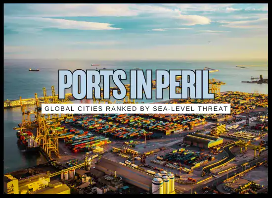
As sea levels rise and storm surges become more intense, some of the world’s busiest port cities are facing an uncertain future. We've ranked the top 12 global port cities, in order, by most physically at risk from sea level rise, based on elevation, land subsidence, exposure to storm systems, and projected flooding through 2100.
While any future projection includes some level of uncertainty, the trends are clear and alarming. These rankings reflect the best-available modeling and research, offering a sobering glimpse at which coastal giants could see the most disruption in the coming decades.

- Massive land subsidence, often over 10 cm per year in some zones.
- Low elevation, many coastal areas sit just above current sea level.
- Rapid, unregulated urbanization across flood-prone land.
- North Jakarta could be 95% submerged under high sea level scenarios.
- Millions of people and Indonesia’s busiest port are at direct risk.
- Construction of a massive sea wall project known as the “Giant Sea Wall.”
- Government plans to relocate the capital to Borneo to relieve pressure.
- Crackdown on illegal groundwater extraction to slow subsidence.
- Jakarta’s dual threat of sinking land and rising seas makes it the most physically vulnerable port city on the planet. Without aggressive engineering and long-term relocation strategies, large parts of the city could become uninhabitable within decades.
- Average elevation is around 1.5 meters, with many areas below high tide levels.
- Severe annual monsoons and intensifying cyclones increase the risk of storm surge and urban flooding.
- Poor drainage systems and aging infrastructure struggle during high tides and heavy rain.
- More than 14 million people could be affected by recurring floods and inundation.
- Critical infrastructure, including the airport and port, may be compromised by rising sea levels.
- Strengthening of river embankments in flood-prone zones.
- Partial restoration of the East Kolkata Wetlands to absorb excess floodwater.
- Development of new satellite zones like New Town on slightly higher, better-planned land.
- Kolkata is among the world’s most exposed cities in terms of population risk. Without major investments in adaptive infrastructure and flood defenses, large parts of the city could face repeated displacement and loss of economic function by late century.
- Much of the city lies at or below 2 meters above sea level.
- Monsoon rains already flood the city regularly; rising seas worsen drainage failures.
- Coastal reclamation projects have reduced natural water absorption and protection.
- Over 11 million residents could be exposed to regular coastal flooding.
- Core financial and industrial districts like Worli and Nariman Point are at direct risk.
- Stormwater drainage upgrades and tide-regulated pumping systems in select districts.
- Mangrove restoration initiatives along the coastline to help buffer storm surge.
- New developments like the Mumbai Coastal Road project aim to raise infrastructure above future sea levels, but coverage is limited.
- Mumbai’s exposure to both sea-level rise and extreme rainfall makes it a climate hotspot. While some projects are underway, the city lacks a unified coastal defense plan, and large swaths remain critically exposed heading into the second half of the century.
- Much of the southern delta region is barely 1–3 meters above sea level.
- Dhaka faces compound risks from upstream flooding, high tides, and poor drainage.
- Chattogram is subsiding, with growing exposure to tidal surges and cyclones.
- Over 11 million people in Dhaka alone could be affected by recurrent flooding.
- Large swaths of the southern coastline could be permanently submerged by late century.
- Bangladesh’s Coastal Embankment Improvement Project is reinforcing flood barriers along hundreds of kilometers of coastline.
- Dhaka has begun limited urban drainage upgrades and is experimenting with pump and canal systems.
- Relocation strategies and flood shelters are being implemented in rural coastal areas, though urban adaptation remains underfunded.
- Bangladesh faces one of the greatest human exposure levels to sea-level rise. While it has taken serious steps in coastal areas, both Dhaka and Chattogram will require massive investment to remain resilient beyond 2050.
- Large portions of Guangzhou lie below 5 meters elevation in a river estuary with limited natural outflow.
- The region is prone to storm surges from powerful typhoons pushing up the Pearl River.
- Reclaimed coastal land and industrial zones have removed natural flood buffers like mangroves and wetlands.
- Guangzhou ranked #1 globally in projected annual flood damage (by value) in multiple international studies.
- Billions in industrial and residential assets face chronic flooding risk in high-sea-rise scenarios.
- China is strengthening levees and pumping systems across the Pearl River Delta.
- Authorities are exploring large-scale movable surge barriers to protect urban cores.
- Mangrove reforestation and sponge city designs are being introduced to manage heavy rainfall and runoff.
- The Pearl River Delta may be the most economically exposed region on this list. Its sheer scale and vulnerability demand cutting-edge adaptation, or the region could suffer hundreds of billions in losses over the coming decades.
- Roughly 45% of the city sits below 1 meter in elevation.
- Significant land subsidence, often 1–2 cm per year, caused by unchecked groundwater pumping.
- Drainage systems struggle against tidal backflow during monsoons and storm tides.
- Up to 7 million residents could be affected by chronic flooding if no additional protections are added.
- Key economic infrastructure, including port terminals and industrial zones, face submersion risk even before 2100.
- Ho Chi Minh City Flood Control Project includes massive tide gates and floodwalls under construction.
- Large underground drainage tunnels are being built to relieve surface runoff during extreme rains.
- Mangrove replanting in suburban coastal districts is being used as a nature-based buffer zone.
- Ho Chi Minh City faces mounting pressure from rising seas and sinking land. While engineering responses are underway, the speed and scale of implementation may fall short without deeper investment and faster execution.
- Many core districts lie between 2–4 meters above sea level, including port and industrial areas.
- Historically rapid land subsidence, up to 2+ meters over the 20th century, has compounded vulnerability.
- Typhoon-driven surges threaten to push seawater far into the Yangtze estuary and Huangpu River.
- Estimated exposure of 5+ million people and hundreds of billions in assets.
- Major commercial zones and transportation corridors risk annual flooding by late century.
- High-standard seawalls already surround much of the urban core, with upgrades ongoing.
- “Sponge city” projects are being implemented to improve water retention and urban drainage.
- Engineers are studying the feasibility of a large-scale movable storm barrier at the Yangtze River mouth.
- Shanghai has the wealth and technical capacity to respond to rising sea levels, but the risks are massive and constant reinforcement will be required. Its success or failure will serve as a global model for other delta cities.
- Average elevation is around 1.5 meters, with some districts even lower.
- Widespread land subsidence continues due to groundwater pumping, often 1–2 cm per year.
- Drainage canals and pumping systems struggle when high tides and monsoon rains coincide.
- Up to one-third of the city may be chronically flooded under high sea-level scenarios by mid-century.
- Approximately 5 million people could be exposed to regular inundation events.
- Large flood tunnels and drainage upgrades are in progress in several core districts.
- Mangrove replanting and wetland restoration east of the city are acting as natural buffers.
- A massive outer sea wall or coastal barrage system is under consideration, but not yet approved.
- Bangkok’s risks are compounded by its topography, rapid urbanization, and sinking land. While soft engineering and water management strategies are in place, larger infrastructure solutions are still needed to prevent widespread disruption in the decades ahead.
- Average elevation is just 1–2 meters, and the region sits atop permeable limestone, allowing seawater to rise up from below.
- Annual king tides already flood streets in many areas, even without storms.
- Vulnerable to hurricane storm surges, which are becoming more intense due to warming seas.
- Over $3.5 trillion in assets could be at risk, the highest projected asset exposure globally.
- Critical infrastructure such as airports, ports, and water treatment facilities face inundation threats.
- Miami Beach has raised roads and installed pump systems to manage tidal flooding.
- Proposals for a $6 billion federal storm surge barrier system are in review.
- Green infrastructure, including living shorelines and restored mangroves, is being expanded along the coast.
- Miami’s flooding problems are no longer hypothetical, they’re happening now. The city is investing heavily in adaptation, but its geology and sprawling development pose long-term challenges that can’t be solved with infrastructure alone.
- Low-lying neighborhoods in Manhattan, Brooklyn, Queens, and Staten Island sit just 1–3 meters above sea level.
- Hurricane storm surge potential is amplified by geography, water funnels into New York Harbor and up tidal rivers.
- Rising sea levels increase the frequency of what were once rare floods.
- Over $2 trillion in assets and hundreds of thousands of homes are located within the expanding floodplain.
- Events like Hurricane Sandy could become decadal or even annual without major intervention.
- The “Big U” seawall and berm system is under construction to protect Lower Manhattan.
- The Army Corps has proposed a $52 billion regional storm surge barrier system for the entire harbor.
- Wetland restoration, new zoning codes, and stormwater infrastructure upgrades are underway across boroughs.
- New York has the resources and urgency to adapt, but its massive coastline and aging infrastructure mean the city must build fast, smart, and flexibly to meet the rising threat over the next century.
- Large portions of the city sit 1 to 2 meters below sea level, protected only by levees and pumps.
- Land subsidence is ongoing due to deltaic soil compaction and historical drainage practices.
- Coastal wetlands that once served as natural buffers are rapidly eroding, increasing surge impact.
- Nearly the entire city could be within the high-risk flood zone under a high sea-level rise scenario.
- Estimated 97% of the population could face displacement if current trends continue unchecked.
- Post-Katrina investment of $14.5 billion upgraded the city’s levee system and added massive surge barriers.
- Coastal restoration projects aim to rebuild marshes and barrier islands to reduce wave energy.
- Ongoing improvements include higher pumping capacity and urban water retention strategies.
- New Orleans is a textbook case of engineered survival. Its future hinges on constant infrastructure upgrades and coastal restoration, any lapse could leave the city catastrophically exposed.
- About 26% of the country lies below sea level, including key urban and port areas.
- Storm surges from the North Sea, combined with river flooding, pose compound threats to the Rhine-Meuse Delta.
- Continued land subsidence in peat-rich areas increases relative sea-level rise over time.
- Over 700,000 people in Amsterdam alone could be affected if current defenses are overtopped.
- Rotterdam, Europe’s largest port, faces major economic risk from prolonged flooding or infrastructure failure.
- The Delta Works system includes surge barriers, dikes, and pumping stations built to withstand 1-in-10,000-year flood events.
- Programs like “Room for the River” and floating architecture projects are redefining flood resilience strategies.
- Authorities are actively studying scenarios beyond 1 meter of sea-level rise, preparing to escalate defenses if needed.
- While the Netherlands is the most prepared nation on this list, rising seas could eventually exceed even their world-class defenses. Long-term survival depends on continuous investment and adaptation at a national scale.
Sea-level rise isn’t a distant threat, it’s already reshaping coastlines and placing billions of dollars in infrastructure, trade, and homes at risk. While some port cities have begun proactive adaptation, others are scrambling to catch up. The difference between survival and retreat will come down to timing, investment, and innovation.
This report highlights cities that are not just vulnerable, but pivotal to global commerce, regional stability, and human safety. The next two decades will be decisive. No one-size-fits-all solution exists, but below is a breakdown of real mitigation strategies being considered or implemented, from nature-based buffers to megastructures that keep the sea at bay.
We welcome your feedback, suggestions, corrections, and ideas for enhancements. Please click here to get in touch.